
Aerial Mapping In Roanoke, TX
Aerial Mapping Experts
Veteran-owned, fully insured, and backed by over 13 years of hands-on drone flying experience.
Manning Drone Services
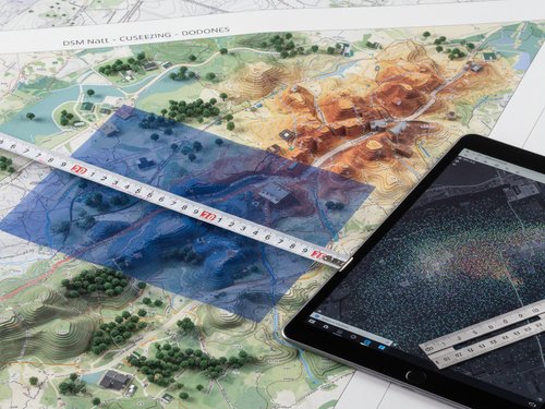
What Is Aerial Mapping?

Aerial mapping is a cutting-edge service that uses drone technology to capture high-resolution images from above and transform them into accurate, detailed maps. Through photogrammetry and orthomosaic processing, Manning Drone Services delivers precise aerial mapping services for construction sites, real estate properties, and land development projects across Texas, Utah, Nevada, and Idaho.
Manning Drone Services
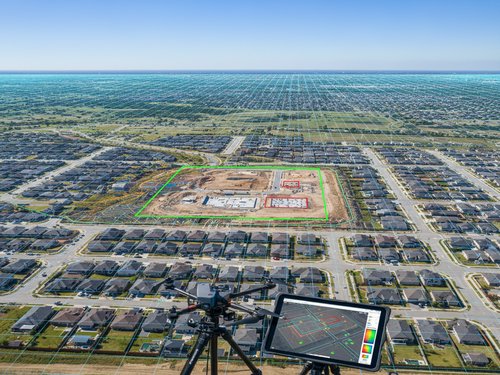
When Is Aerial Mapping Necessary?
Aerial mapping services are essential when you need accurate, up-to-date visual data for planning, monitoring, or marketing. Whether it's tracking construction progress in Fort Worth, surveying land in Denton, or creating property visuals in Dallas, drone aerial mapping provides faster and more cost-effective insights compared to traditional methods.
Manning Drone Services
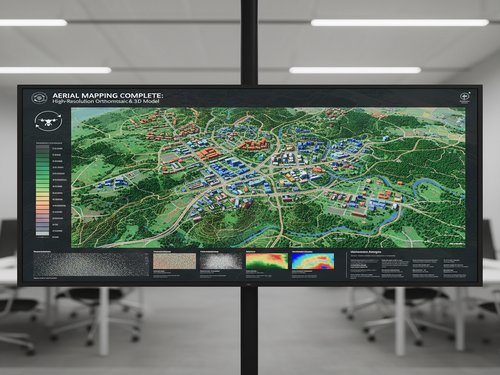
What Is Required For Aerial Mapping?
To perform aerial mapping, a licensed drone operator, advanced imaging equipment, and specialized software for photogrammetry are required. Manning Drone Services uses industry-leading tools to ensure accurate data collection and processing, delivering high-quality orthomosaic maps that support better decision-making for construction, real estate, and land management projects.
TESTIMONIALS
What Our Aerial Mapping Customers Say About Us
The Process
3 Step Process For Your Aerial Mapping Needs

Contact Us
Start by completing the 'Get a Free Quote' form on our website to share your Aerial Mapping needs with us.

Schedule Your Estimate
Next, we'll arrange a property visit at a time that works for you to provide an in-person estimate for your Aerial Mapping needs.

Get The Job Done
After you approve our estimate, we'll schedule a date to complete the job. Our team will work hard to exceed your expectations!
Request A Free Aerial Mapping Quote
GET A FREE QUOTE
BUSINESS
SERVICES
SERVICE AREAS
OPERATING HOURS
Sun: 8:00am - 8:00pm
Mon: 8:00am - 8:00pm
Tue: 8:00am - 8:00pm
Wed: 8:00am - 8:00pm
Thu: 8:00am - 8:00pm
Fri: 8:00am - 8:00pm
Sat: 8:00am - 8:00pm